The platform · layer 02
Edge View
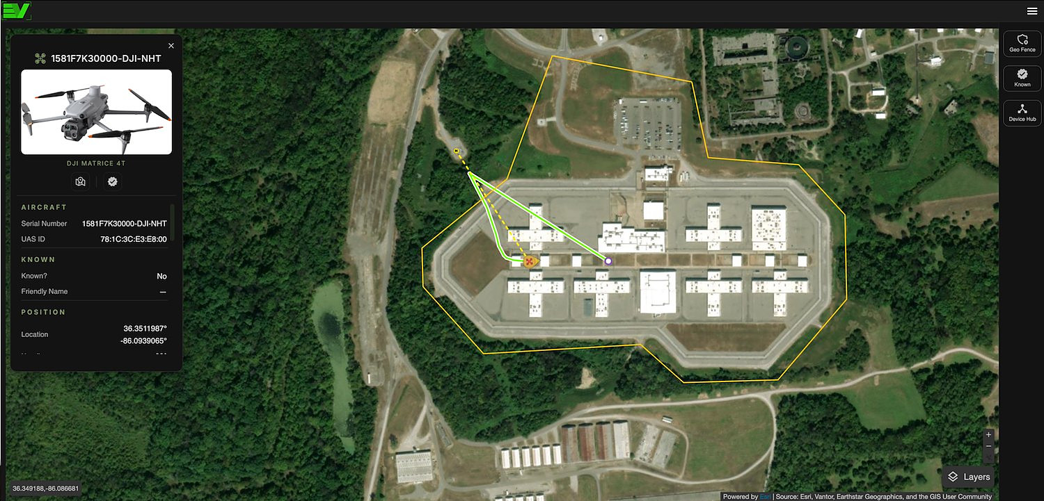
Every Edge Scout you own on one map, with geofencing, alerting and the automated report you’ll actually need afterwards. Make an account and watch real detections right now, without owning a sensor.
How it fits
The middle layer of one system
Sensors feed it. It feeds your TAK Server. Nothing between those three is an integration you have to make work — we have taken care of all of it.
Sensors
Any Edge Scout — portable or fixed, one unit or twenty. Link and Tower sync themselves; portable units sync when they see a network.
MoreEdge View
Merges overlapping detections into one track with higher fidelity, holds the history, draws the geofences, provides notifications and detailed reporting.
Your TAK Server
The TAK Bridge pushes your fleet — plus every public detection on the map — to a TAK Server you run, as Cursor-on-Target. Included with Pro — Private.
MoreTry it before you buy anything
Create an account, open the map, and watch real drone and aircrafy activity. No sensor, no card, no sales call.
The free map makes the paid one better
Free and personal-tier detections are shared, so every additional sensor sharpens the picture for every other user. On Pro — Private, your own detection data stays yours and stays out of public view.
What it does
Built while sitting alongside the operators who needed a solution
Know your own aircraft
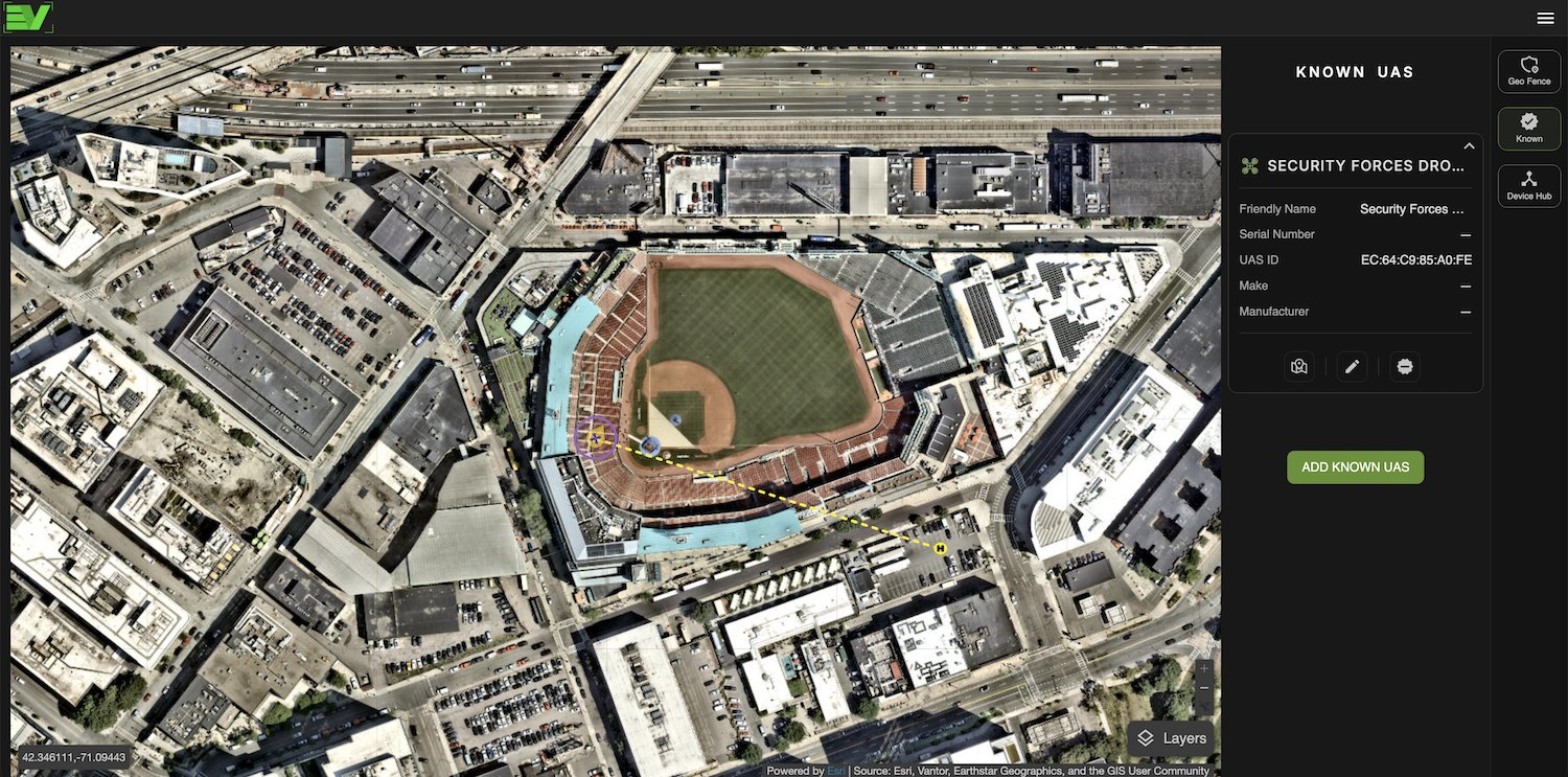
Tag the drones you expect — the contracted photographer, your own UAS team, the utility’s inspection flight. Everything else then stands out immediately, which is most of the job.
Layers that matter operationally
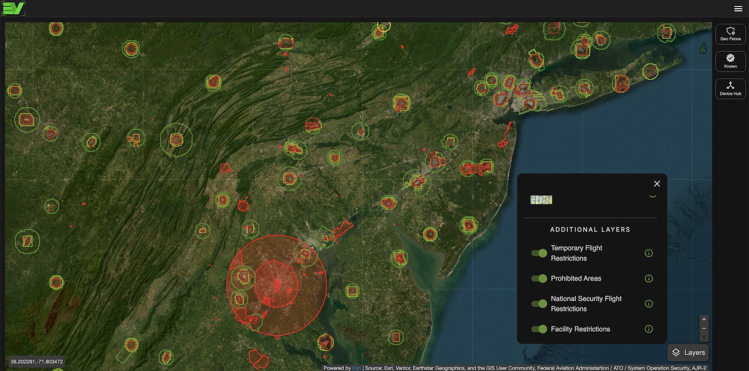
Street, satellite and aeronautical basemaps, plus temporary flight restrictions and restricted airspace — so a detection has context without opening a second application or the tedious process of importing data overlays.
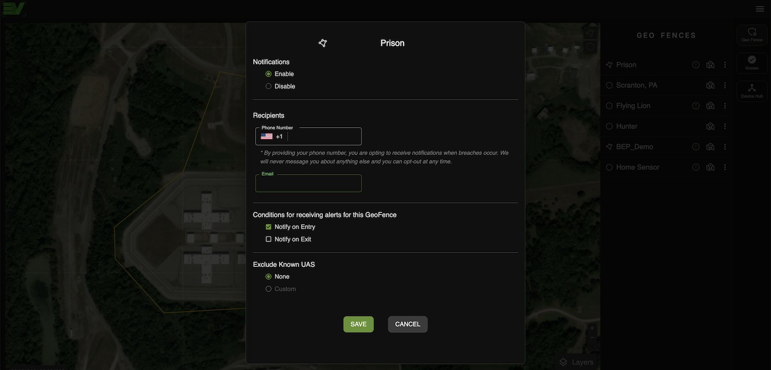
Alerts to the people who act
Geofence by radius or polygon and route breaches by SMS and email. An alert without context is just noise. Our alerts link you immediately to the data you need.
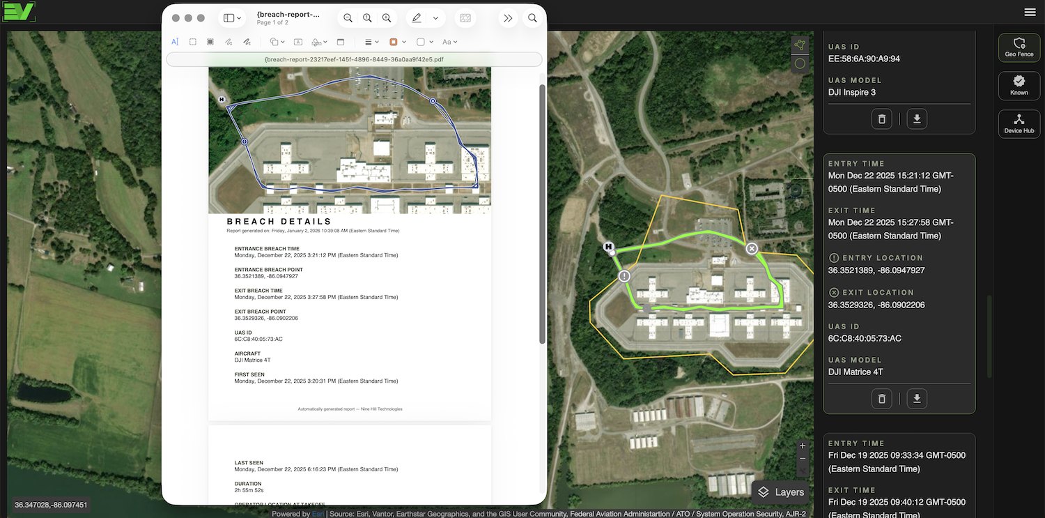
The report is the point
Automated breach reports with timestamp, aircraft identity, flight path and operator position — PDF with a KML track. The moment after an incident you have professional looking documentation for the post brief.
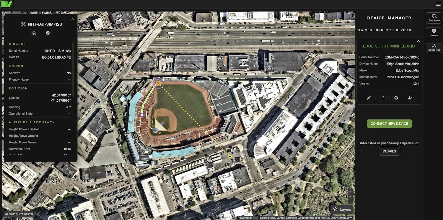
Fleet administration
Device Manager for sensor health, link state and configuration across your whole deployment. Running twenty sensors is as easy as running one.
Pricing
Published, because you shouldn’t need a sales call to find out
Annual billing is cheaper
Free
No sensor required
forever
Make an account and watch real public detections on a live map before you spend anything.
- Seats
- 1 user
- SMS alerts
- —
- Email alerts
- —
- Live detection map
- Public community detections
- Connect your own sensors
- No sensor required to sign up
Personal
Non-commercial
or $120 a year
For individual operators and hobbyists managing their own airspace.
- Seats
- 1 user
- SMS alerts
- 50/month
- Email alerts
- Unlimited
- Everything in Free
- Geofencing by radius or polygon
- Known-drone tagging
- Flight history
Pro
Where most agencies land
or $300 a year
The working tier for a venue or facility running a real deployment.
- Seats
- Owner + 3 users
- SMS alerts
- 300/month
- Email alerts
- Unlimited
- Everything in Personal
- Automated breach reports (PDF + KML)
- Additional map overlays, such as TFRs
Pro — Private
or $500 a year
Everything in Pro, plus TAK Server integration and detection data kept private to your organization.
- Seats
- Owner + 3 users
- SMS alerts
- 500/month
- Email alerts
- Unlimited
- Everything in Pro
- Private detection data
- Edge Scout TAK Bridge — push detections to your whole network
Who can see it, and who can change it
The account owner is an administrator, and assigns a role to everyone they add: administrator, or read-only user. Administrators create and edit geofences and their notification settings. Read-only users see the same map and the same detections, but cannot change what is watched or who gets told.
Personal is a single user. Pro and Pro — Private include the owner and up to three more, and further seats are $5 a month or $50 a year each.
An administrator can also share their geofences, and the notifications attached to them, with users in other paid Edge View accounts — which is how mutual aid, or a venue and the agency covering it, work from the same picture without duplicating sensors. Text alerts sent that way count against the sharing account’s SMS allowance, not the recipient’s.
How the SMS allowance works
Text alerts fire on a geofence breach. Personal includes 50 a month, Pro 300, and Pro — Private 500. Unused messages roll over rather than expiring at the end of the month.
Need more, run a bundle: 1,000 messages for $30. Email alerts are unlimited on every paid tier and cost nothing.
For grant writers
FEMA’s Counter-UAS Grant Program lists software and subscription services among allowable detection costs. At $500 a year, an Edge View Pro — Private license is a line item that clears review without a justification memo. Procurement detail →
Release notes
What shipped, and when
We push Edge View updates continuously. Each release has its own notes — what new features were added, what changed, and what was fixed.
| Release | Highlights |
|---|---|
| August 2026 Settings area, SMS credits with usage history and low-balance warnings, unlimited alert recipients per geo-fence, shared users with read-only and admin roles, geo-fence colors, flight history and exports in Device Manager, and reports drawn on satellite imagery. Read the notes | Settings area, SMS credits with usage history and low-balance warnings, unlimited alert recipients per geo-fence, shared users with read-only and admin roles, geo-fence colors, flight history and exports in Device Manager, and reports drawn on satellite imagery. Read the notes |
Start with the free tier
Create an Edge View account, get detections, then decide whether you want to take the next step to feeding it with your own sensors.